
Exactement cet exemplaire ira dans le panier
Paramètres
- 147pages
- 6 heures de lecture
En savoir plus sur le livre
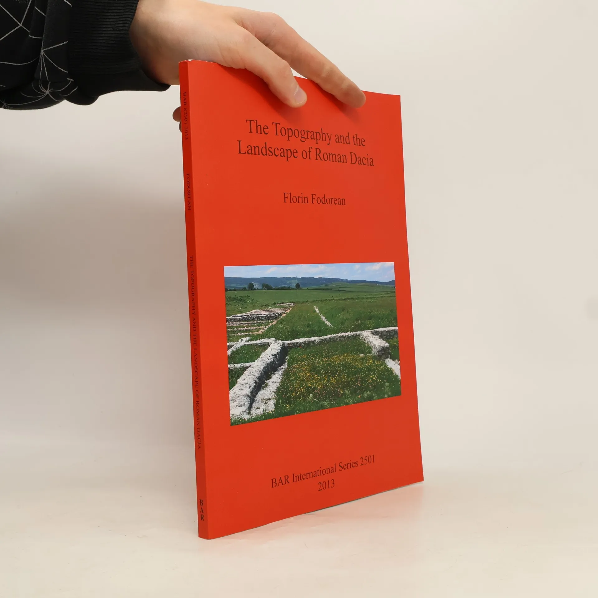
The study delves into the topography and landscape of Roman Dacia, exploring its road network and geographical perceptions before and after the Roman conquest. It analyzes ancient sources, including the 'Tabula Peutingeriana' and archaeological remains, to reconstruct the main roads. The author also investigates rural settlements like Potaissa and Napoca, along with Roman bridges. By integrating historical cartography and modern digital data, the work offers a comprehensive recreation of the landscape of Roman Dacia, highlighting its historical significance.
Achat du livre
The Topography and the Landscape of Roman Dacia, Florin-Gheorghe Fodorean
- Langue

- Année de publication
- 2013
- product-detail.submit-box.info.binding
- (souple),
- État du livre
- Très bon
- Prix
- 13,49 €
Modes de paiement
Personne n'a encore évalué .
- Titre
- The Topography and the Landscape of Roman Dacia
- Langue
- Anglais
- Auteurs
- Florin-Gheorghe Fodorean
- Publié
- 2013
- Format
- souple
- Pages
- 147
- ISBN10
- 1407311174
- ISBN13
- 9781407311173
- Séries
- Mots clés
- Nonfiction, Sciences sociales, Thème historique, Histoire du monde, Archéologie, Rome antique, Saint Empire romain, Archéologie paysagère
- Description
- The study delves into the topography and landscape of Roman Dacia, exploring its road network and geographical perceptions before and after the Roman conquest. It analyzes ancient sources, including the 'Tabula Peutingeriana' and archaeological remains, to reconstruct the main roads. The author also investigates rural settlements like Potaissa and Napoca, along with Roman bridges. By integrating historical cartography and modern digital data, the work offers a comprehensive recreation of the landscape of Roman Dacia, highlighting its historical significance.